Skip to search
Skip to main content
Skip to first result
Skip to limit your search
Skip to search
Duke University Libraries
Repository
Collections & Archives
Search
{:label=>"Search"}
Login
Ask
Menu
Menu
Login
Ask a Librarian
Search & Find
Using the Library
Research Support
Course Support
Libraries
About
Search
Search Constraints
New Search
You searched for:
Collection Group
Data and Visualization Services
✖
Remove constraint Collection Group: Data and Visualization Services
Year
1900
to
1999
✖
Remove constraint Year: <span class="from" data-blrl-begin="1900">1900</span> to <span class="to" data-blrl-end="1999">1999</span>
« Previous
|
41
-
60
of
269
|
Next »
Sort
by title
relevance
title
date (old to new)
date (new to old)
Number of results to display per page
20
per page
per page
10
per page
20
per page
50
per page
100
per page
View results as:
List
List
Gallery
Gallery
Search Results
41.
Disturbances - 1975
Date:
1975
Collection:
Duke Forest GIS Layers
42.
Disturbances - 1986
Date:
1986
Collection:
Duke Forest GIS Layers
43.
Duke Forest GIS Layers
Date:
1931; 1944; 1952; 1963; 1975; 1986
Format:
ZIP; HTML; KMZ; JPEG
44.
Durham Aerial Imagery (USDA)
Date:
1955; 1960; 1966 to 1967
Format:
KMZ; GIF; JPEG
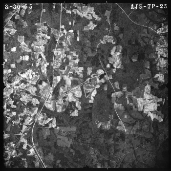
45.
Durham Aerial Imagery (USDA) - 1955
Date:
March 30, 1955; April 16, 1955
Collection:
Durham Aerial Imagery (USDA)
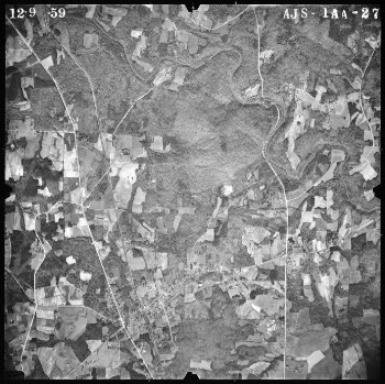
46.
Durham Aerial Imagery (USDA) - 1960
Date:
December 9, 1959; January 9, 1960; January 15, 1960; January 23, 1960
Collection:
Durham Aerial Imagery (USDA)
47.
Durham Aerial Imagery (USDA) - 1966
Date:
October 21, 1966; October 30, 1966; October 31, 1966; January 24, 1967
Collection:
Durham Aerial Imagery (USDA)
48.
Durham Aerial Imagery (USDA) - Index Images and Grids for Image Selection
Date:
1955; 1960; 1966
Collection:
Durham Aerial Imagery (USDA)
49.
Durham GIS Features - Planning / Land Use / Development / Zoning
Date:
1998; 2002; 2004; 2006 to 2010
Format:
ZIP; HTML; KMZ
50.
Durham GIS Features - Transportation
Date:
1998; 2006 to 2010
Format:
HTML; KMZ; ZIP
51.
ESRI Data and Maps 1996
Date:
1996
Format:
ZIP
52.
ESRI Data and Maps 1999
Date:
1999
Format:
ZIP
53.
Euratlas Historical Political Boundaries of Europe
Date:
1 to 2000
Format:
TXT; HTML; ZIP
54.
Europe - Administrative Unit Boundaries
Date:
1999
Collection:
ESRI Data and Maps 1999
55.
Europe - Cities
Date:
1999
Collection:
ESRI Data and Maps 1999
56.
Europe - Country Boundaries
Date:
1999
Collection:
ESRI Data and Maps 1999
57.
Europe - Major Rivers
Date:
1999
Collection:
ESRI Data and Maps 1999
58.
Europe - Major Urban Areas
Date:
1999
Collection:
ESRI Data and Maps 1999
59.
Europe - Populated Places
Date:
1999
Collection:
ESRI Data and Maps 1999
60.
Europe - Province/State Demographics
Date:
June 25, 1905
Collection:
ESRI Data and Maps 2003
« Previous
Next »
1
2
3
4
5
6
7
…
13
14
Limit your search
Collection Group
Data and Visualization Services
✖
[remove]
269
Collection
ESRI Data and Maps 1999
95
Duke Forest GIS Layers
51
ESRI Data and Maps 1996
39
Latin American Public Opinion Project
39
National Sample Survey (India)
6
more
Collection
»
Year
1900
to
1999
✖
[remove]
269
1900
to
1909
17
1910
to
1919
2
1920
to
1929
2
1930
to
1939
8
1940
to
1949
10
1950
to
1959
20
1960
to
1969
20
1970
to
1979
23
1980
to
1989
32
1990
to
1999
183
Current results range from
1000
to
2015
Year range begin
Year range end
View larger »
Creator
National Archives and Records Administration
3
Central Board of Statistics, Indonesia
2
Bensen, Clark Hamilton
1
Center for the Americas at Vanderbilt
1
Flemming, Peter A., Mickolus, Edward F., Murdock, Jean M., Sandler, Todd
1
more
Creator
»
Format
ZIP
13
XLS
7
PDF
6
HTML
4
KMZ
4
more
Format
»
Subject
Public opinion
39
Social conditions
39
Social surveys
39
Agriculture
1
Agriculture and Fisheries
1
more
Subject
»
Language
English
61
Spanish; Castilian
39
Indonesian
2
Location
United States
146
North Carolina
61
Canada
19
Mexico
19
Europe
15
more
Location
»
Collecting Area
Center for Data and Visualization Sciences
21
Contact us
Contact us
×